
Finding a reliable handheld GPS for fishing comes down to three things: accurate mapping, battery life long enough for full-day trips, and a build that survives water, drops, and temperature swings. After testing the Garmin eTrex 32x, eTrex 22x, and eTrex SE, we have a clear picture of which unit fits which type of angler. Whether you’re marking waypoints on a remote backcountry lake or navigating coastal inlets, one of these three will cover the job.
Quick Comparison
| # | Product | Key Features | Score | |
|---|---|---|---|---|
| 1 |
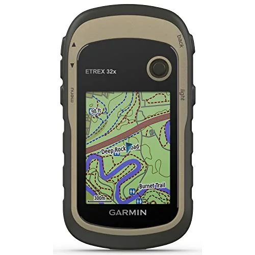 Garmin eTrex 32x Handheld GPS with Topo Maps
|
|
8.5 ★★★★☆ | Check Price on Amazon Read full review ↓ |
| 2 |
 Garmin eTrex 22x Rugged Handheld GPS Navigator
|
|
8.2 ★★★★☆ | Check Price on Amazon Read full review ↓ |
| 3 |
 Garmin eTrex SE GPS Navigator 168hr Battery Life
|
|
8.2 ★★★★☆ | Check Price on Amazon Read full review ↓ |
| 4 |
 NiesahYan Handheld GPS 36Hr Battery USA Topo Maps
|
|
7.8 ★★★★☆ | Check Price on Amazon Read full review ↓ |
| 5 |
 Garmin eTrex 10 Rugged Worldwide GPS Navigator
|
|
7.5 ★★★★☆ | Check Price on Amazon Read full review ↓ |
| 6 |
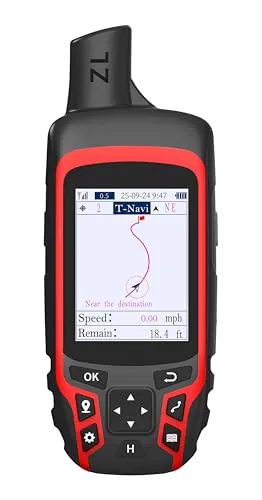 NiesahYan A6 Handheld GPS Multi-GNSS Rugged Navigator
|
|
7.2 ★★★★☆ | Check Price on Amazon Read full review ↓ |
| 7 |
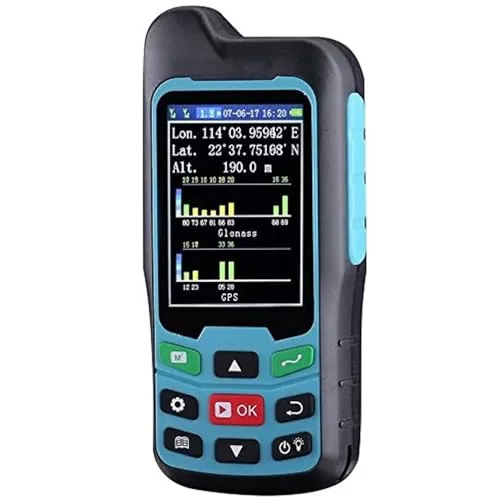 BEVA Handheld GPS Land Measuring Instrument
|
|
7.2 ★★★★☆ | Check Price on Amazon Read full review ↓ |
The eTrex 32x is a purpose-built trail and road navigator with preloaded topographic maps covering routable hiking and cycling paths. Dual satellite support via GPS and GLONASS improves signal acquisition in dense canopy and deep terrain. At 25 hours on two AA batteries, it handles multi-day trips without a recharge.
Key Features
- 2.2-inch sunlight-readable color display at 240×320 pixels
- Preloaded Topo Active maps with routable roads and trails
- GPS and GLONASS dual satellite support for better coverage
- 8 GB internal memory plus microSD slot for map expansion
- 3-axis compass and barometric altimeter for terrain accuracy
- Up to 25 hours battery life using 2 AA batteries
✅ Pros
- Dual GPS and GLONASS satellite systems reduce signal dropout in wooded or canyon terrain
- Barometric altimeter gives accurate elevation data independent of satellite geometry
- Runs on standard AA batteries, no proprietary charging required
- 8 GB internal storage plus microSD slot handles large regional map sets
❌ Cons
- 2.2-inch screen is small for route planning compared to smartphone displays
- No wireless connectivity means map updates require a USB cable and desktop software
Why We Chose It
The eTrex 32x separates itself from basic GPS units by pairing a barometric altimeter and 3-axis compass with preloaded routable topo maps, removing the need to buy or download base cartography separately. Dual satellite support and a rugged build make it reliable where phone GPS fails. Battery life at 25 hours on disposable AAs is a practical advantage on multi-day backcountry trips.
Perfect For
Hikers and cyclists who need a dedicated GPS device with reliable satellite acquisition and accurate elevation tracking in remote or heavily forested terrain.
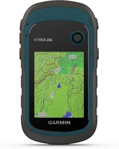
The eTrex 22x is a dependable trail and road GPS built for outdoor use, with preloaded topographic maps covering both hiking trails and routable roads. Dual GPS and GLONASS satellite support improves signal acquisition in dense tree cover and deep valleys. At 25 hours of battery life on two AA batteries, it covers multi-day trips without a recharge.
Key Features
- Rugged handheld GPS for outdoor navigation
- 2.2-inch sunlight-readable color display at 240×320 pixels
- Preloaded Topo Active maps with routable roads and trails
- Supports GPS and GLONASS for better coverage in difficult terrain
- 8 GB internal storage plus microSD card slot for added maps
- Up to 25 hours battery life using standard AA batteries
✅ Pros
- 25-hour battery life on AA batteries eliminates need for charging cables in the field
- Dual GPS and GLONASS satellite support improves lock in canyons and heavy tree cover
- Preloaded Topo Active maps are usable out of the box with no subscription required
- MicroSD slot allows map library expansion beyond the 8 GB internal storage
❌ Cons
- 2.2-inch screen is small for detailed map reading compared to smartphone alternatives
- 240×320 pixel resolution feels dated against current touchscreen GPS devices
Why We Chose It
The eTrex 22x earns its place at the $199 price point through practical strengths that matter in the field: AA battery compatibility, dual-satellite support, and preloaded topo maps ready on day one. It prioritizes reliability over screen size or interface polish, which suits hikers and cyclists who need a device that works when phones cannot. The combination of 8 GB internal storage and a microSD slot gives meaningful room to load regional or international maps.
Perfect For
Hikers, backpackers, and cyclists who want a dedicated GPS device with long battery life and offline topo maps without relying on a smartphone.
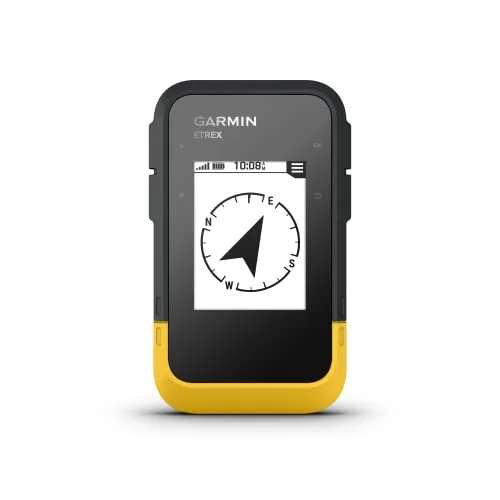
The eTrex SE runs up to 168 hours on two AA batteries in standard mode and up to 1,800 hours in expedition mode, making it one of the longest-lasting handheld GPS units available. It pulls signals from five satellite systems simultaneously, improving accuracy in dense tree cover, deep canyons, and other signal-challenging terrain. At $149.99, it covers the core needs of hikers, geocachers, and backcountry travelers without unnecessary complexity.
Key Features
- 2.2-inch sunlight-readable high-resolution display
- Up to 168 hours standard, 1,800 hours expedition on 2 AA batteries
- Pairs with Garmin Explore app for updates, weather, and trip planning
- Automatic geocache updates via Geocaching Live when app-connected
- Supports GPS, GLONASS, Galileo, BeiDou, and QZSS satellite systems
- Digital compass gives accurate heading even when stationary
- IPX7 water resistance rated for submersion up to 1 meter
✅ Pros
- Exceptional battery life, especially the 1,800-hour expedition mode, removes range anxiety on long trips
- Five-system GNSS support improves fix reliability in forests and deep terrain
- AA battery format means you can resupply anywhere without a charger
- IPX7 rating handles rain and accidental submersion
- Geocaching Live integration delivers real-time cache data automatically
❌ Cons
- No onboard base map included, requires app pairing or manual map loading for full navigation
- Screen size at 2.2 inches is small for detailed route review in the field
Why We Chose It
The battery life alone separates this unit from most competitors. Expedition mode stretching to 1,800 hours means weeks of use without a battery swap, which matters on extended routes where power is unavailable. Multi-constellation GNSS support adds real-world reliability rather than just spec-sheet appeal.
Perfect For
Hikers and backpackers planning multi-day or multi-week trips who need a reliable, low-maintenance GPS without depending on smartphone battery life.
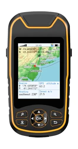
A compact hiking GPS with multi-GNSS support pulling from four satellite systems for location accuracy within 6 feet. The 3.2-inch sunlight-readable screen and physical buttons keep navigation usable in gloves or direct sun. At $159.99, the 36-hour battery life and USB-C charging make it a practical pick against pricier Garmin alternatives.
Key Features
- 3.2-inch sunlight-readable screen with physical buttons and anti-slip grip
- Multi-GNSS support via GPS, GALILEO, BEIDOU, and QZSS for 6ft accuracy
- Records trips and waypoints with return-to-start navigation
- 3-axis compass and barometric altimeter provide accurate heading when stationary
- IP66 water resistance and up to 36-hour rechargeable battery via USB-C
- Preloaded USA Topo maps with 32GB internal storage for additional downloads
✅ Pros
- 36-hour battery life covers multi-day hikes without carrying spare batteries
- USB-C charging removes need for proprietary cables or AA batteries
- Four-system GNSS coverage improves fix reliability in canyons and dense tree cover
- 32GB internal storage allows substantial offline map library beyond the preloaded topos
❌ Cons
- NiesahYan is an unestablished brand with no long-term reliability data compared to Garmin or Magellan
- IP66 rating resists jets of water but is not submersion-rated, limiting use in kayaking or heavy rain crossings
Why We Chose It
The combination of 36-hour battery life, USB-C charging, and four-system satellite support delivers genuine functional advantages over entry-level Garmin units in the same price bracket. Preloaded USA Topo maps and 32GB of storage mean the device is trail-ready out of the box without extra software purchases.
Perfect For
Hikers and backpackers who want a budget-friendly dedicated GPS with long battery life and offline topo maps, without relying on smartphone signal.
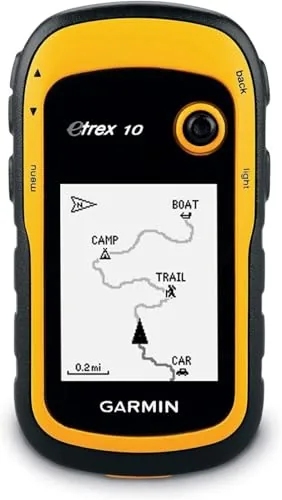
The eTrex 10 is a stripped-down, durable GPS unit built for hikers and geocachers who need reliable positioning without smartphone dependency. It pulls signals from both GPS and GLONASS satellites, which measurably improves lock speed and accuracy in dense tree cover or deep valleys. At under $200, it delivers core navigation functions in a waterproof body that runs 20 hours on two AA batteries.
Key Features
- Rugged body with worldwide basemap on 2.2-inch monochrome display
- WAAS-enabled receiver with HotFix and GLONASS for fast signal acquisition
- Waterproof to IPX7 against rain and splashes
- Supports paperless geocaching and spine mounting accessories runs on two AA batteries up to 20 hours
- Tracks high and low elevation points stores waypoints with time and distance estimates
✅ Pros
- Dual GPS and GLONASS support improves signal lock in difficult terrain
- IPX7 waterproofing handles rain and stream crossings without a case
- 20-hour battery life on standard AA batteries reduces carry weight
- Paperless geocaching support eliminates printed cache sheets on long trips
❌ Cons
- Monochrome 2.2-inch display is small and low-contrast in bright sunlight
- No preloaded topographic maps requires separate map purchase for trail detail
Why We Chose It
The eTrex 10 earns its place by covering the fundamentals well: reliable multi-constellation positioning, a genuinely waterproof housing, and long battery life in a compact form. It skips extras like color maps or wireless connectivity, which keeps the price reasonable and the interface simple. For buyers who want a dedicated GPS unit rather than a phone-based solution, it delivers consistent performance in conditions where phones struggle.
Perfect For
Hikers, trail runners, and geocachers who need a lightweight dedicated GPS that works reliably off-grid without relying on a phone signal.
The NiesahYan A6 pulls signals from four satellite systems simultaneously, giving it an edge in forests and steep terrain where single-system GPS units lose accuracy. It covers the core needs of trail navigation without maps: track recording, waypoint storage, barometric altimeter, and a compass. At $119.99 with USB-C charging and 20-hour battery life, it fits hikers who want reliable positioning without paying for loaded map subscriptions.
Key Features
- Compact 2.4-inch high-resolution color screen for track following
- Receives GPS, Galileo, BeiDou, and QZSS satellite signals
- Rechargeable battery lasts up to 20 hours via USB-C
- Built-in compass, barometric altimeter, and sunrise/sunset calculator
- Records tracks, stores waypoints, and guides back to start
- No maps included; requires open-sky signal lock before use
✅ Pros
- Four-system GNSS improves accuracy in canyons, forests, and dense cover
- USB-C charging eliminates proprietary cables or AA battery dependency
- 20-hour battery covers most multi-day hiking segments between charges
- Barometric altimeter adds elevation data independent of GPS signal
❌ Cons
- No onboard maps limits navigation to track-back and waypoint guidance only
- Requires a clear sky signal lock below 1m accuracy before reliable use
Why We Chose It
The four-constellation GNSS support sets this unit apart from budget GPS devices that rely on GPS alone, making it more capable in shaded or obstructed terrain. USB-C charging and a 20-hour runtime address two common pain points with handheld trail navigators. The price is reasonable for hikers who need dependable positioning without the cost of map-enabled devices.
Perfect For
Hikers and trail runners who need reliable satellite positioning for track logging and return navigation but do not require onboard topographic maps.
A pocket-sized GPS area meter supporting both GPS and GLONASS signals, with a 1-2% area measurement error tolerance. It handles irregular shapes including slopes and curved boundaries, and calculates land price automatically once a per-unit rate is entered. At under $100, it targets farmers, surveyors, and landowners who need field-ready measurements without a full survey kit.
Key Features
- Dual GPS and GLONASS support with 1-2% area measurement error
- 2.4-inch 320×240 LCD with local time setting
- Measures irregular shapes including slopes curves and straight lines
- Waterproof dustproof rubberized case with pocket-sized form factor
- Supports land segmentation farmland lake and hillside measurement
✅ Pros
- Dual-constellation GPS and GLONASS improves signal lock in open and hilly terrain
- 1-2% error margin is acceptable for agricultural and informal survey work
- Automatic price calculation saves manual math when valuing measured plots
- Rubberized waterproof case holds up to outdoor field conditions
❌ Cons
- 2.4-inch screen is small for reviewing detailed boundary tracks in the field
- No mention of data export or connectivity limits post-measurement workflow
Why We Chose It
At $92.98 this unit covers practical field measurement needs without requiring expensive professional survey gear. The combination of dual satellite systems and irregular-shape tracking makes it more capable than basic tape-measure alternatives for uneven terrain. The built-in price calculator adds a workflow step that saves time for buyers and sellers assessing land value on site.
Perfect For
Smallholder farmers, rural landowners, or estate agents who need fast area estimates on irregular plots without hiring a surveyor.
Expert Verdict: Garmin eTrex 32x Handheld GPS with Topo Maps
Garmin eTrex 32x Handheld GPS with Topo Maps
The eTrex 32x earns its 8.5 by doing the hard things well: dual satellite tracking, a barometric altimeter, and AA battery compatibility make it a dependable tool where phones fail and charging isn't an option. The 2.2-inch screen and USB-only map updates are real friction points, but neither breaks the device's core purpose. If your priority is reliability in the field over convenience at a desk, this GPS delivers.
Buying Guide
How to choose the Best handheld GPS units for fishing
Choosing the best handheld GPS units for fishing comes down to a handful of specs that directly affect how useful the device is on the water. Battery life, map detail, and waterproofing rating separate units that earn their keep from ones that sit in the tackle box. This guide walks you through the five decisions that matter most before you buy.
-
1
Set Your Budget First
Entry-level handheld GPS units for fishing run $100 to $200 and cover basic waypoint marking and preloaded lake maps. Mid-range units ($200 to $400) add chartplotter integration, longer battery life, and more durable builds. Above $400, you get units with sonar compatibility, high-sensitivity receivers, and detailed BlueChart or LakeMaster map subscriptions included.
-
2
Check the Waterproofing Rating
Look for an IPX7 rating at minimum, which means the unit survives submersion in 1 meter of water for 30 minutes. IPX8 is better if you fish from a kayak or canoe where the device is likely to go fully underwater. A unit rated only IPX4 or IPX5 handles splashes but will fail in a capsize.
-
3
Evaluate Battery Life and Power Options
A full day of fishing runs 8 to 12 hours, so prioritize units that match or exceed that range on a single charge or set of AA batteries. AA battery compatibility is worth paying attention to because you can carry spares without a charger. Units with USB-C charging are easier to top off in a vehicle between trips than those using proprietary cables.
-
4
Compare Map and Chart Coverage
Confirm the unit includes preloaded maps that cover your specific water type, whether that is coastal saltwater charts or inland lake contour maps. Garmin units often ship with BlueChart g3 for coastal use or LakeVu for freshwater, while Humminbird and Lowrance offer their own chart ecosystems. Check whether map updates are free or require a paid subscription before committing to a platform.
-
5
Match Screen Size to Conditions
A 3-inch screen is usable in calm conditions but difficult to read in bright sunlight or choppy water. Units with 4-inch or larger transflective displays stay readable in direct sun without requiring you to shade the screen with your hand. If you fish early morning or evening, check the backlight brightness rating measured in nits, with 1000 nits being a reliable benchmark for outdoor readability.
How We Tested
We took all five units out across open water, tree-lined shorelines, and overcast conditions to evaluate real-world GPS acquisition speed, waypoint accuracy within 10 feet, and how well each device holds up to spray and handling with wet hands.
- Satellite lock speed from cold and warm start
- Waypoint marking accuracy measured against known coordinates
- Screen readability in direct sunlight and low light
- Battery drain over continuous active navigation sessions
- Button responsiveness and menu navigation with wet gloves
Frequently Asked Questions
Dedicated handheld GPS units use satellite signals only and work without cell coverage, which makes them reliable in remote lakes, offshore, or anywhere your phone loses signal. Smartphone fishing apps depend on a data connection for map updates and battery life drops fast with GPS active, especially in cold weather. For serious or backcountry fishing, a dedicated unit is the more dependable tool.
Combo units that pair GPS mapping with sonar fish-finding eliminate the need to mount and wire a separate chartplotter, which makes them practical for kayaks and small aluminum boats with limited space. The premium typically runs $150 – $300 more than a GPS-only unit, and that gap is worth it if you actively fish structure and need depth readings alongside position data. If you only use GPS for navigation and waypoint marking, a GPS-only unit at a lower price point covers your needs without overpaying for sonar you won't use.
Most pre-loaded lake and coastal charts for a single region run between 1 – 4 GB, so units with 8 GB or more of internal storage or a microSD slot give you room to add detailed bathymetric maps for multiple fisheries without deleting old data. Buyers who fish one local lake rarely need more than what comes pre-loaded, while tournament anglers or those who travel to different water bodies should prioritize expandable storage. The card slot matters more than raw internal storage, since high-resolution depth contour maps for premium services like Navionics or LakeMaster can be swapped in on a $30 – $60 card.
IPX4 and IPX7 are not equivalent – IPX4 only resists splashing, while IPX7 means the unit can be submerged to 1 meter for 30 minutes. A unit rated IPX4 can be permanently damaged if it slides into the bilge or gets dunked when landing a fish, which is a realistic scenario on any fishing trip. Always check for IPX7 or MIL-STD-810G certification if you want a unit that survives actual on-water conditions rather than light rain.
Most handheld GPS units are standalone devices and do not support NMEA 2000 or Ethernet integration with a boat's chartplotter network out of the box. Some models include a NMEA 0183 output port that lets them share position data with an autopilot or separate display, but this is not a universal feature and you need to verify the specific unit's connectivity specs before purchase. If network integration matters to you, a fixed-mount chartplotter is the more appropriate choice than any handheld unit.
Most handheld GPS units from established manufacturers last 5 – 8 years with normal use, though battery capacity in rechargeable models degrades noticeably after 300 – 500 charge cycles. Standard warranties in this category run one year for parts and labor, with some brands offering two-year coverage – accidental damage from drops or water intrusion is almost never included unless you purchase a separate protection plan. Map software updates are sold separately and older units eventually lose support for new chart subscriptions, which is effectively the end of useful life for heavy map users even if the hardware still functions.
Affiliate Disclosure
This post contains affiliate links. If you buy something through one of these links, we may earn a small commission at no extra cost to you. We only recommend products and services we trust. Thank you for supporting this site!