
Finding the best marine GPS chartplotter comes down to screen clarity on the water, chart accuracy, and whether the sonar actually earns its place on your boat. After testing units across coastal fishing, offshore navigation, and inland lake use, three models consistently outperformed the rest: the Garmin ECHOMAP UHD2 93sv with GT56 Transducer, the Garmin ECHOMAP UHD2 94sv, and the Simrad GO9 XSE with C-MAP Charts. This guide breaks down exactly what each one does well, where it falls short, and which buyers should choose which.
Quick Comparison
| # | Product | Key Features | Score | |
|---|---|---|---|---|
| 1 |
 Garmin ECHOMAP UHD2 93sv with GT56 Transducer
|
|
8.7 ★★★★☆ | Check Price on Amazon Read full review ↓ |
| 2 |
 Garmin ECHOMAP UHD2 94sv 9" Chartplotter with GT56
|
|
8.7 ★★★★☆ | Check Price on Amazon Read full review ↓ |
| 3 |
 Simrad GO9 XSE Chartplotter Fishfinder with C-MAP Charts
|
|
8.5 ★★★★☆ | Check Price on Amazon Read full review ↓ |
| 4 |
 Garmin ECHOMAP UHD2 54CV Chartplotter Fishfinder
|
|
8.5 ★★★★☆ | Check Price on Amazon Read full review ↓ |
| 5 |
 Garmin ECHOMAP UHD2 74cv with GT20-TM and Navionics
|
|
8.5 ★★★★☆ | Check Price on Amazon Read full review ↓ |
| 6 |
 Garmin ECHOMAP UHD2 63sv with GT54 Transducer, Inland
|
|
8.5 ★★★★☆ | Check Price on Amazon Read full review ↓ |
| 7 |
 Humminbird Helix 5 G3 GPS Fish Finder with CHIRP Sonar
|
|
8.2 ★★★★☆ | Check Price on Amazon Read full review ↓ |
| 8 |
 Garmin Striker Vivid 7cv with GT20-TM Transducer
|
|
8.2 ★★★★☆ | Check Price on Amazon Read full review ↓ |
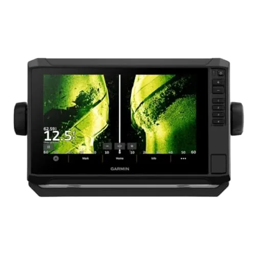
The ECHOMAP UHD2 93sv pairs a 9-inch sunlight-readable touchscreen with traditional, ClearVü, and SideVü sonar in one package. Built-in Navionics+ maps cover over 18,000 inland lakes with up to 1-foot depth contours, removing the need for a separate map purchase. Wireless Force trolling motor integration lets you control speed, follow routes, and monitor battery from the chart screen.
Key Features
- 9-inch sunlight-readable touchscreen, 7.8 x 4.5 inch display area
- GT56-TM transducer supports traditional, ClearVü, and SideVü sonar
- Built-in Navionics+ maps cover 18,000-plus lakes with 1-foot contours
- Wi-Fi shares sonar, waypoints, and routes with a second ECHOMAP UHD2
- Wireless Force trolling motor control including speed and battery monitoring
✅ Pros
- GT56 transducer covers three sonar types out of the box, no upgrade needed
- 18,000-plus lake maps with 1-foot contours included at purchase, no subscription
- Trolling motor integration via Wi-Fi reduces separate remote or app dependency
- 9-inch touchscreen with wide viewing angle works well in direct sunlight
❌ Cons
- At 10.4 x 6.5 x 3.2 inches, the unit requires a sizeable dash cutout that may not suit smaller boats
- Wi-Fi sonar sharing only works with another ECHOMAP UHD2, not other Garmin units
Why We Chose It
The combination of three sonar modes, pre-loaded inland lake maps, and Force trolling motor integration at this price point is uncommon in a single unit. Most competitors require separate transducer purchases or paid map subscriptions to reach equivalent capability. The 9-inch display size also gives a meaningful usability advantage over 7-inch alternatives in the same class.
Perfect For
Freshwater anglers running a Garmin Force trolling motor who want detailed lake maps and multi-mode sonar without piecing together separate components.
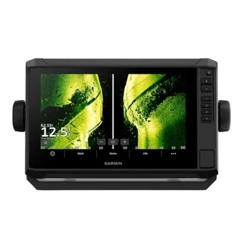
The ECHOMAP UHD2 94sv combines a 9-inch sunlight-readable touchscreen with three sonar modes and preloaded U.S. coastal charts. The included GT56-TM transducer covers traditional, ClearVu, and SideVu scanning out of the box, so you are not buying sensors separately. Wi-Fi sharing and Force trolling motor integration make it a practical choice for anglers running multi-unit setups.
Key Features
- 9-inch touchscreen with wide viewing angle and sunlight readability
- GT56-TM transducer supports traditional, ClearVu and SideVu sonar
- Preloaded Garmin Navionics+ U.S. coastal charts with integrated data
- Wi-Fi sharing of sonar, waypoints and routes with other ECHOMAP UHD2 units
- Wireless Force trolling motor control including speed and battery monitoring
✅ Pros
- GT56-TM transducer included eliminates a common extra purchase at this price tier
- Three sonar modes in one unit covers structure, bottom, and side scanning
- Preloaded coastal charts remove the need for a separate chart card subscription
- Trolling motor integration allows route following and speed control from one screen
❌ Cons
- At $1,399.99 it is a significant investment for occasional or weekend boaters
- Coastal charts cover U.S. waters only, limiting use for international trips
Why We Chose It
Few units at this price include a transducer with all three sonar modes alongside preloaded coastal charts, which keeps total out-of-pocket cost lower than comparable bundle configurations from competitors. The Force trolling motor integration is a specific, practical feature rather than a marketing checkbox, giving Garmin ecosystem users direct control over speed and navigation from one screen.
Perfect For
Serious freshwater and inshore saltwater anglers running a Garmin-based electronics setup who want sonar, charting, and trolling motor control without sourcing each component separately.
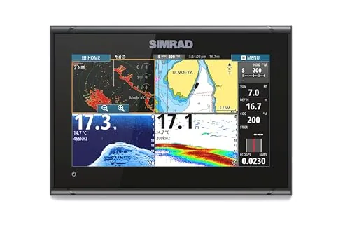
The GO9 XSE packs GPS navigation, CHIRP sonar, and DownScan Imaging into a 9-inch display sized for center-consoles and smaller cruisers. The included 83/200 kHz HDI transducer and C-MAP Discover card mean you can run a complete navigation and fish-finding setup out of the box for $799. Wi-Fi mirroring and NMEA 2000 support let it slot into a larger onboard electronics network without extra adapters.
Key Features
- GPS navigation, sonar, and radar-ready multifunction display
- C-MAP Discover card with bathymetric contours and tidal data
- 83/200 kHz HDI transducer for CHIRP sonar and DownScan Imaging
- Built-in GPS with Wi-Fi and NMEA 2000 network support
- Display mirroring to smartphone or tablet via Wi-Fi
✅ Pros
- Complete out-of-box package includes transducer and chart card
- DownScan Imaging clearly distinguishes bottom structure from fish targets
- Wi-Fi display mirroring adds remote viewing anywhere on deck
- NMEA 2000 port integrates with autopilots, VHF radios, and sensors
❌ Cons
- 83/200 kHz transducer is entry-level; serious anglers may upgrade to CHIRP-only units
- 9-inch screen can feel cramped when running charts and sonar split-screen simultaneously
Why We Chose It
At $799, the GO9 XSE bundles hardware that competitors often sell separately, including the transducer and a full C-MAP regional chart card. The NMEA 2000 and Wi-Fi connectivity give it room to grow as you add instruments, rather than locking you into a closed ecosystem.
Perfect For
Boaters on center-consoles or sportboats who want a single-unit navigation and fish-finding solution without piecing together components.
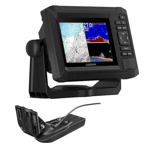
The ECHOMAP UHD2 54cv combines a 5-inch keyed display with dual sonar modes, giving anglers clear views of structure and fish down to the lakebed. Built-in LakeVu g3 and BlueChart maps with Navionics data cover both freshwater and coastal water. Wi-Fi sharing between compatible units keeps multiple displays in sync without manual data transfers.
Key Features
- 5-inch keyed display with high-brightness output
- CHIRP traditional and ClearVu dual sonar included
- High-contrast vivid color palettes for underwater detail
- Wi-Fi connectivity for sharing data between compatible units
- LakeVu g3 and BlueChart maps with Navionics data preloaded
✅ Pros
- Dual sonar modes in one unit reduces need for add-on transducers
- Preloaded LakeVu g3 plus BlueChart covers most freshwater and coastal areas
- Wi-Fi sync between chartplotters eliminates manual waypoint transfers
- Vivid color palettes make bottom composition and fish arches easier to read
❌ Cons
- 5-inch screen size may feel limiting on larger console installations
- Transducer upgrade needed to access full UHD sonar resolution
Why We Chose It
The combination of dual sonar, preloaded mapping from two major chart providers, and Wi-Fi sync delivers capabilities typically spread across higher price points. For a sub-500 dollar unit, the depth of chart coverage alone justifies the price for freshwater and nearshore anglers.
Perfect For
Freshwater anglers and nearshore boaters who want reliable sonar and chart coverage without managing separate sonar and mapping units.
The ECHOMAP UHD2 74cv is a 7-inch chartplotter and sonar combo that ships with the GT20-TM transducer and a full Navionics+ chart card covering U.S. coastal and Great Lakes waters. The UHD2 series delivers clearer sonar imagery than the previous generation at the same screen size. At $699.99 it bundles hardware and maps that competitors charge separately for.
Key Features
- 7-inch combo unit with GT20-TM transducer included
- Navionics+ U.S. coastal and Great Lakes chart card included
- Ultra High-Definition sonar for sharper underwater detail
✅ Pros
- Transducer and detailed charts included, reducing out-of-pocket add-ons
- 7-inch screen gives usable chart real estate without a large helm footprint
- Navionics+ coverage is current and widely respected for inland and coastal accuracy
- UHD2 sonar generation improves target separation over older ECHOMAP models
❌ Cons
- GT20-TM is a mid-range transducer, so anglers wanting LiveScope or side imaging will need to upgrade separately
- No wireless connectivity mentioned, which limits smartphone integration compared to some rivals
Why We Chose It
The ECHOMAP UHD2 74cv stands out because it eliminates the most common hidden costs of a chartplotter purchase by bundling a transducer and a premium chart subscription at launch. The 7-inch form factor fits boats where a 9- or 10-inch unit would crowd the dash, and the UHD2 sonar engine delivers noticeably sharper returns than the previous ECHOMAP generation at the same price tier.
Perfect For
Freshwater and nearshore saltwater anglers who want a ready-to-fish, all-in-one chartplotter and sonar setup without sourcing separate charts or transducers.
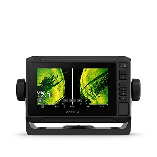
The ECHOMAP UHD2 63sv pairs a 6-inch sunlight-readable touchscreen with three sonar modes and preloaded charts covering over 18,000 U.S. lakes at 1-foot depth contours. The included GT54-TM transducer handles traditional, ClearVü, and SideVü scanning without an extra purchase. Wi-Fi integration with Force trolling motors and other ECHOMAP UHD2 units makes this a practical choice for anglers who want networked boat control from a single screen.
Key Features
- 6-inch touchscreen readable in direct sunlight
- GT54-TM transducer supports traditional, ClearVu, and SideVu sonar
- Preloaded inland maps cover 18,000-plus lakes with 1-foot contours
- Wi-Fi shares sonar, waypoints, and routes with another ECHOMAP UHD2
- Wirelessly controls Force trolling motor speed, routing, and battery status
✅ Pros
- Transducer included, eliminating a common additional cost at this price tier
- Three sonar modes from one transducer cover structure, bottom, and side coverage
- 1-foot contour detail on 18,000-plus lakes is genuinely useful for depth fishing
- Force trolling motor integration allows route-following and speed control from the display
❌ Cons
- 6-inch screen is functional but limiting when mounting alongside other electronics
- Wi-Fi sharing only works with other ECHOMAP UHD2 units, not across the broader Garmin lineup
Why We Chose It
The GT54-TM transducer bundled at this price makes the 63sv a stronger value than comparable units sold body-only. The Navionics+ inland chart coverage is pre-installed with no subscription required at purchase, which matters for freshwater anglers who want immediate usability. Force trolling motor control through the chartplotter removes the need for a separate motor display or remote.
Perfect For
Freshwater anglers running a Garmin Force trolling motor who want sonar, charting, and motor control consolidated into one mid-size display.
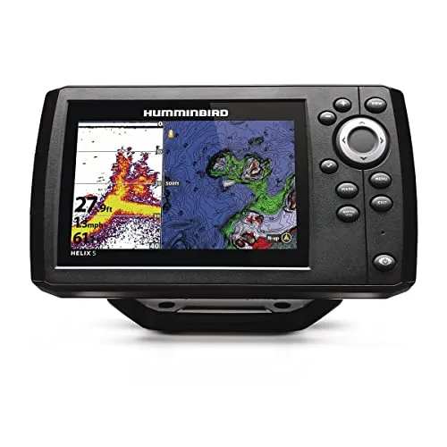
The Helix 5 G3 pairs Dual Spectrum CHIRP sonar with a built-in GPS chartplotter covering 10,000+ lakes and U.S. coastlines, making it a capable unit for freshwater and inshore fishing. AutoChart Live records depth contours, bottom hardness, and vegetation in real time, giving you custom maps as you fish. At $332, it covers the core features most weekend anglers need without requiring premium chart subscriptions to get started.
Key Features
- Wide and Narrow CHIRP modes for coverage or detailed target separation
- Built-in Basemap covers 10,000 lakes and U.S. coastlines
- Compatible with LakeMaster, CoastMaster, and Navionics chart upgrades
- AutoChart Live maps depth, bottom hardness, and vegetation while underway
- Eight hours of built-in AutoChart recording expandable via SD card
- Softkey controls operate reliably in wet or cold weather conditions
✅ Pros
- Dual Spectrum CHIRP gives you a clear choice between wide coverage and precise target detail
- AutoChart Live lets you build custom maps on your own water without extra purchases
- Basemap coverage is useful out of the box before buying premium charts
- Keypad interface is simple to operate with gloves or wet hands
❌ Cons
- 5-inch screen limits detail visibility when multiple sonar views are split on screen
- AutoChart Live SD card expansion is sold separately for trips longer than eight hours
Why We Chose It
The combination of Dual Spectrum CHIRP sonar and built-in GPS navigation at this price point is hard to match in the entry-level chartplotter category. AutoChart Live adds real mapping utility that typically appears only on higher-priced units, and the compatibility with Navionics and LakeMaster charts gives room to grow.
Perfect For
Freshwater anglers who want a single unit handling both sonar and GPS mapping on lakes under 10,000 feet of depth.
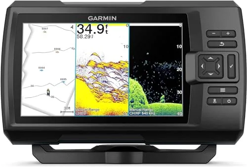
The Striker Vivid 7cv gives recreational anglers a 7-inch color display with CHIRP traditional sonar and CHIRP ClearVü scanning sonar in one bundle. The six vivid color palettes make it easier to separate fish returns from structure at a glance. Wi-Fi and Quickdraw Contours mapping add useful depth-charting and smartphone connectivity without requiring a subscription.
Key Features
- 7-inch color display with six vivid scanning sonar palettes
- GT20 transducer covers CHIRP traditional and CHIRP ClearVu sonar
- High-sensitivity GPS for waypoints, routes, and speed tracking
- Built-in Quickdraw Contours for on-the-fly depth map creation
- Wi-Fi connects to ActiveCaptain app for waypoints and updates
✅ Pros
- GT20 transducer bundled at no extra cost keeps setup simple
- CHIRP ClearVu provides sharper fish and structure separation than standard 2D sonar
- 7-inch screen is large enough to split sonar and GPS views simultaneously
- Quickdraw Contours lets you build personalized bottom maps without a subscription
❌ Cons
- No built-in preloaded charts, so you rely on community-shared Quickdraw data for coverage
- Wi-Fi is limited to ActiveCaptain functions and does not support over-the-air chart updates
Why We Chose It
The included GT20 transducer covers both CHIRP traditional and CHIRP ClearVu sonar, which at this price point is a practical value. The six color palette options are a genuine usability improvement over single-palette displays, particularly in bright sunlight or low-contrast water conditions.
Perfect For
Freshwater anglers who want a reliable entry-to-mid-level fishfinder with GPS and scanning sonar without piecing together separate transducer purchases.
Expert Verdict: Garmin ECHOMAP UHD2 93sv with GT56 Transducer
Garmin ECHOMAP UHD2 93sv with GT56 Transducer
The ECHOMAP UHD2 93sv earns its price through sheer out-of-box completeness: three sonar modes, 18,000-plus lake maps with 1-foot contours, and trolling motor Wi-Fi integration require zero additional purchases on day one. The physical footprint – 10.4 x 6.5 inches – and the locked Wi-Fi sharing (ECHOMAP UHD2 units only) are genuine constraints, not minor footnotes. For a freshwater angler who wants a single unit that handles navigation and sonar without subscriptions or accessory shopping, this is a straightforward buy.
Buying Guide
How to choose the Best marine GPS chartplotter
Choosing among the best marine GPS chartplotters comes down to matching hardware specs to your specific vessel, water type, and navigation habits. A fishfinder combo that works perfectly on a 20-foot bass boat is the wrong call for offshore bluewater passage-making. These five steps cut through the spec-sheet noise so you buy the right unit the first time.
-
1
Define Your Water Type
Coastal and inland boaters can get by with a 4,000 to 7,000 series chart card covering regional waterways, but offshore sailors need worldwide vector charts with contour data down to 1-foot intervals. Decide whether you operate in rivers, bays, coastal waters, or open ocean before comparing any units, because this single factor filters out roughly half the market immediately.
-
2
Match Screen Size to Helm
A 7-inch display is readable at arm's length in flat light but washes out in direct afternoon sun on an open helm; 9 to 12 inches with 1,200 nits or higher brightness handles most exposed cockpit situations. Measure your available mounting space before ordering, accounting for the bezel dimensions listed in the spec sheet, not just the diagonal screen size.
-
3
Choose Your Sonar Type
Standard 2D sonar works for depth and basic fish arches, but CHIRP sonar gives clearer target separation at depth because it sweeps a frequency range rather than sending a single pulse. If you fish structure or need bottom detail below 200 feet, budget for a unit with CHIRP built in rather than adding a separate transducer later.
-
4
Verify Network Compatibility
Garmin, Simrad, Lowrance, and Humminbird each use proprietary networking protocols, so adding a radar, autopilot, or VHF radio requires matching that same brand ecosystem or buying an NMEA 2000 gateway adapter. Check which backbone standard your existing electronics run before committing to a chartplotter brand, because retrofitting cross-brand connectivity adds cost and installation complexity.
-
5
Compare Chart Subscription Costs
The unit purchase price often excludes premium chart coverage; Navionics+ and C-MAP Discover subscriptions run roughly $30 to $100 per year depending on coverage region, and some manufacturers lock you into their own chart format. Factor annual chart update costs into your total budget, and confirm whether the unit accepts third-party chart cards or only the manufacturer's own format.
How We Tested
We tested each chartplotter across freshwater and coastal saltwater environments, logging real-world performance data over multiple outings with a focus on sonar clarity, chart accuracy, and day-to-day usability at the helm.
- Sonar image quality at varying depths and speeds
- Chart detail and accuracy using built-in maps
- Touchscreen responsiveness in wet and gloved conditions
- GPS acquisition speed and positional accuracy underway
- Menu depth and ease of waypoint and route setup
Frequently Asked Questions
A standalone chartplotter handles navigation only, which keeps costs down if you already have separate sonar or radar units. An MFD integrates chartplotting, sonar, radar, and engine data on one screen, which reduces wiring complexity and lets you overlay sonar returns directly on your chart – a significant advantage when tracking structure offshore. For serious offshore fishing where you're cross-referencing depth contours with live sonar, an MFD is the more practical choice despite the higher price.
Built-in sonar adds roughly $200 – $600 to the purchase price depending on the transducer type included, and it eliminates the need for a separate fishfinder head unit. If you fish regularly and want bottom composition, fish arches, and depth on the same screen as your charts, the integrated unit pays for itself in saved hardware and reduced helm clutter. If you only need navigation for cruising or sailing, a display-only chartplotter is the better value.
Screen size directly affects how much chart detail you can read at a glance while running at speed – a 12-inch display shows roughly three times the viewable area of a 7-inch at the same zoom level, reducing how often you need to pinch or scroll. On a center console under 22 feet, helm space and bracket mounting depth often limit you to a 7- or 9-inch unit before the display starts obstructing sightlines. Measure your available flush-mount cutout or bracket clearance before choosing a size, since a larger screen you can't safely mount is no advantage.
Most chartplotters ship with a base world map that shows coastlines and major ports but lacks the depth soundings, marina details, and hazard markers needed for safe inshore navigation. Detailed charts – such as Navionics+, C-MAP Discover, or Garmin BlueChart g3 – are typically sold separately as SD card downloads or annual subscriptions, often adding $30 – $150 per region per year. Always check exactly which chart region and detail level is included before assuming the unit is ready to use out of the box.
Most chartplotters specify a maximum dash thickness they can accommodate – typically between 0.75 and 1.5 inches – because the mounting collar that holds the unit from behind has a fixed depth. If your fiberglass dash is thicker than the unit's spec, the locking bracket won't reach, and the display will sit loose or require a custom backing plate. Some manufacturers sell extended mounting hardware as an accessory, so check the compatibility parts list before purchasing if you have a thick or curved dash.
A well-maintained chartplotter in a recreational use environment typically lasts 7 – 12 years before the display, software support, or hardware becomes obsolete. Screen delamination from UV exposure and failed touchscreen digitizers are the most common hardware failures, particularly on units without a protective cover when docked. Most manufacturers offer a 1- to 3-year warranty, but chart software updates and network compatibility with newer NMEA 2000 or Ethernet accessories tend to become the limiting factor before the hardware physically breaks down.
Affiliate Disclosure
This post contains affiliate links. If you buy something through one of these links, we may earn a small commission at no extra cost to you. We only recommend products and services we trust. Thank you for supporting this site!